Project Summary
The proposed Grandpark Trails Specific Plan (GTSP) area consists of approximately 3,484.1 acres located east of State Highway 99, west of the Natomas East Main Drainage Pond, north of the City of Sacramento and proposed Grandpark Trails Specific Plan, and south of Sutter County and Agricultural lands. The GTSP establishes a framework and strategy for development of the plan area, including proposed land use designations, policies, development and design standards, and plans for infrastructure and public services. The plan provides for 15,944 housing units with a mixture of densities that supports all population segments; 29 active parks; and an extensive plan-wide multi-use trail system.
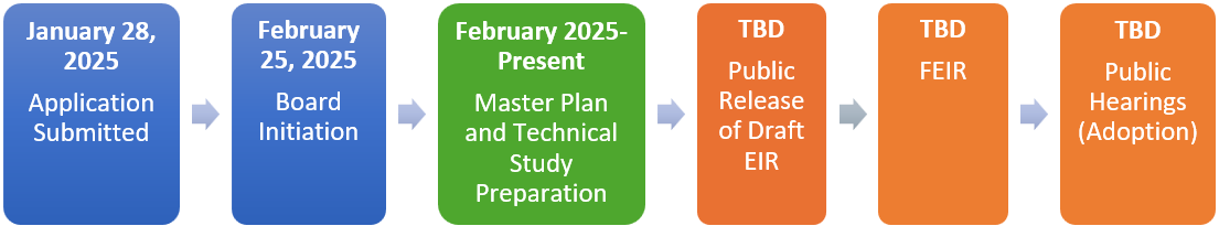
Project Timeline
Updates and Upcoming Events
- Notice of Preparation Public Scoping Meeting. A meeting will be held virtually on August 12, 2025 at 6:30pm to provide an overview of the Proposed Project and EIR process and receive public comments. The meeting can be accessed here.